Hastingleigh.com A Genealogy Website /One Place Study Contact e-mail
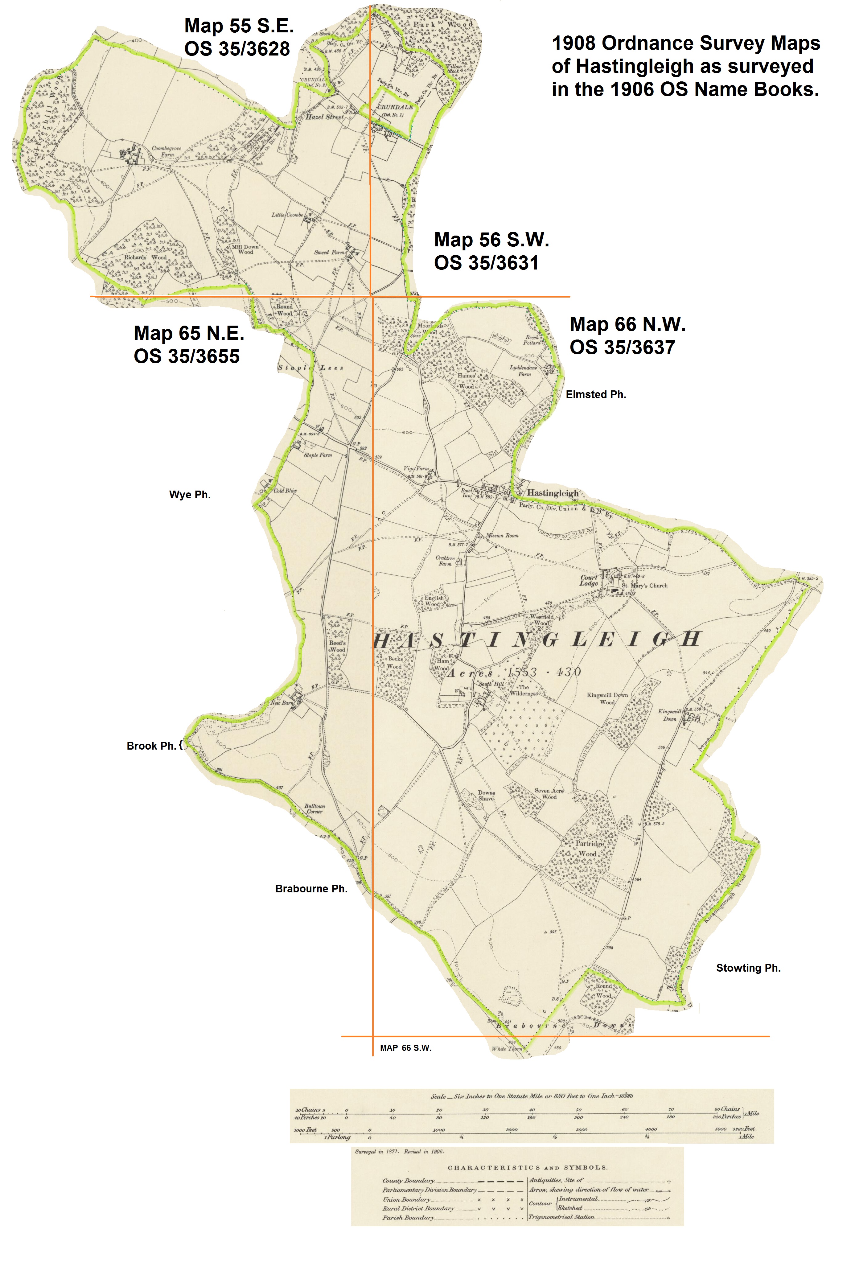
Hastingleigh on Ordnance Survey Maps surveyed in 1906The following image is taken from 5 Sheets of Kent Maps printed in 1908.
Map Numbers 55 S.E., 56 S.W., 65 N.E. and 66 N.W and 66 S.W.
The original full maps can be viewed on an external website for the Library of Scotland.
MAP 55 S.E. Click=North West of the parish, Coombegrove and Richards Wood, over to the Wye Crown.
MAP 56 S.W. Click=North East corner of the parish including previously "Waltham detached No.1"
MAP 65 N.E. Click=South West of the parish, Cold Blow, New Barn to Bull Town Corner
MAP 66 N.W. Click=for central Village area , South Hill, Kingsmill Down and South East corner.
MAP 66 S.W. Click=southern tip of the parish, showing Whitethorn on the Brabourne Downs.

