SSSI (Sites of Special Scientific Interest):Hastingleigh.com A Genealogy Website /One Place Study contact e-mail
Listed Buildings in Hastingleigh
There are 21 listed structures or buildings in the Parish, 3 sites of special scientific interest
and just one protected woodland.
The entire parish is within the Kent Downs Area of Outstanding Natural Beauty (AONB.)
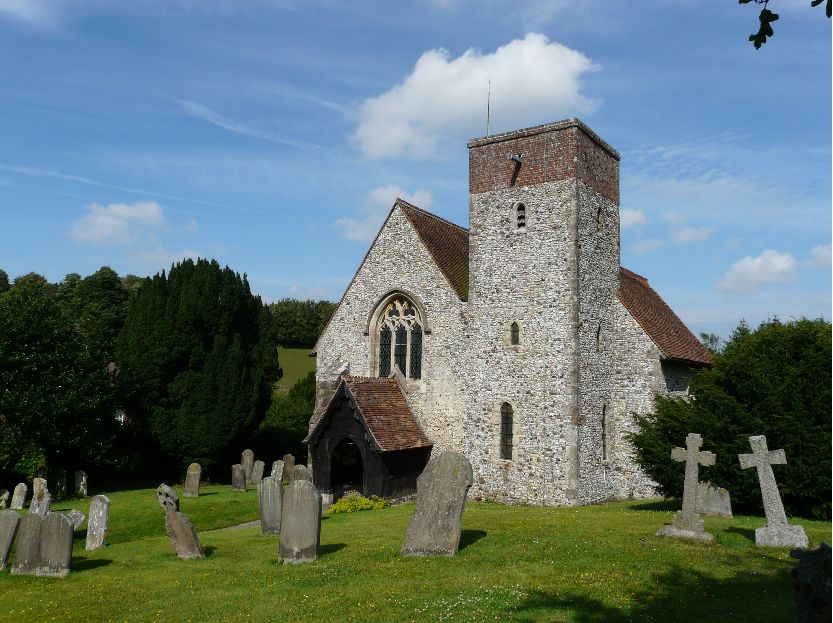
1.The Church of St Mary The Virgin (Click for Gallery)
[A Grade 1 listed building]
formerly known as 'Our Lady of Hastingleigh' in the 15th century.
This is an ancient building probably of a Saxon foundation (if not earlier) and certainly of Norman design.
It has many rare features for a church in Kent and has been the focal point of recorded Parish life and history
for centuries. The church is commonly refered to as an 11th century church, the tower and the chancel are said to date from
the 13th century as does the church's oldest window. The porch dates from the 14th century and has protected the door jambs
from weathering. 15th and 16th century carvings in the door jambs have been a source of mystery and speculation for many years
and I have identified a few of them as the signature marks of churchwardens.
The church shows evidence of being colourfully decorated in mediaeval times. Some murals
uncovered in the 1960's are visable on the south east corner walls inside the church.
2.& 3. Grave stones of George Leggett and Joseph Holmes.
[Grade 2 Listed structures]
Quite why just these two stones are listed when there are others from the same era in the churchyard which are not, is a mystery.
They are No.s 124 and 126 on the grave yard North of Church Map (Click) and cemetery inscriptions. (Click)NB. It has been suggested that the two listings were a token gesture, to preserve the graveyard from suffering the sad fate of Elmsted's graveyard, where most of the stones were removed to the perimiter to enable easier grass cutting.
The other 18th century grave stones which are not listed but perhaps ought to be are :
grave stone 003 George Leggett c.1780
grave stone 105 The Chatbourn family c.1760s
grave stone 122 John Stickles and wife c.1780s
grave stone 123 Mary Leggett c.1770
grave stone 129 Abigail Swaine c.1768
grave stone 130 Nicholas Swaine c.1760
grave stone 131 Swaine family children c.1750s
grave stone 132 John Swaine c.1797
grave stone 133 Thomas Swaine c.1789
grave stone 138 Nicholas Swaine Jnr. c.1798
grave stone 148 Hannah Swaine c.1782
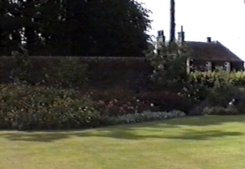
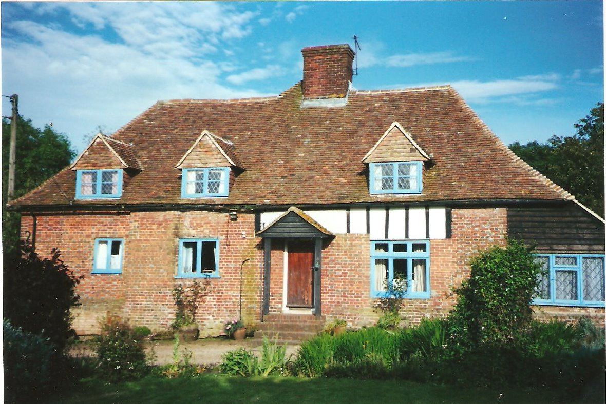
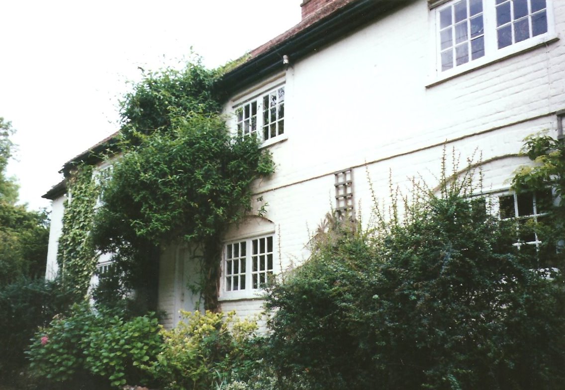
4. The Old Rectory
[Grade 2 Listed building]
(private residence)
parts of this house date to the 1500's with later additions, notably those done in the 19th century reycling bricks from the former Elmsted Vicarage. This property was the home of many Rectors of Hastingleigh until Rev. Anthony Collett, during whose incumbancy the Rectory was sold in to private ownership and the money raised from the sale funded the building of a new residence in Bodsham.
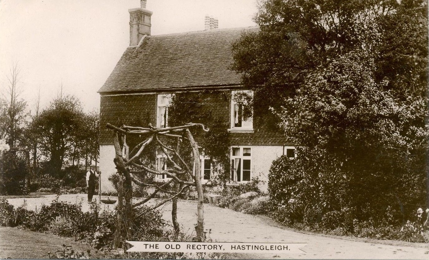
Photo postcard c.19105.
Tithe Barn at the Old Rectory
[Grade 2 Listed building]
(private residence)
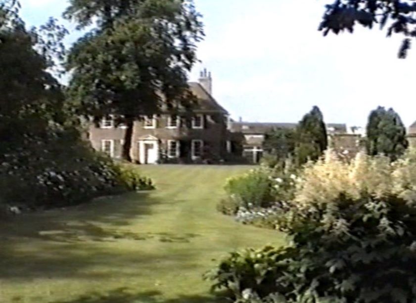
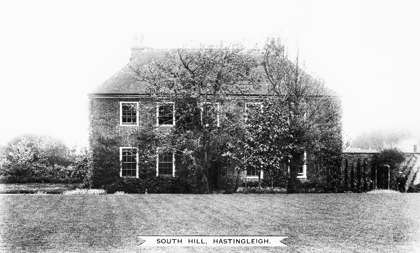
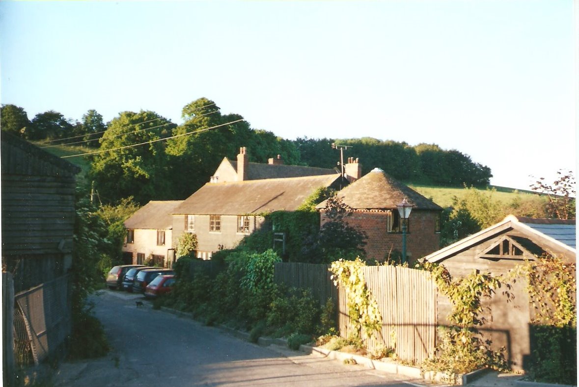
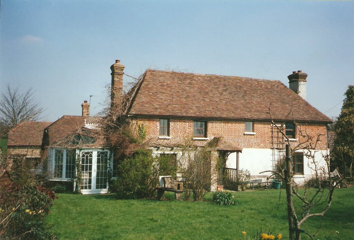
6. South Hill Farm House
[Grade 2 Listed building]
(private residence)
Parts of the house date too the 1600's and there was a property here long before that. The South Hill estate supported the income of the Rector in earlier years. This estate was the home of the Hawke family. Dr. William Harvey's maternal grandparents lived here in the 1500's. John and Amy Hawke whose grave stone in in the church aisle, lived at South Hill in the 1500's.
(Photo circa 1993 above)
(Post card circa 1910 below)7. South Hill Garden Wall
[Grade 2 Listed structure]
The high wall can be seen between the main road and the house. It runs on the opposite side of the road from The Old Rectory. It must be 7-8 feet high and built of red brick.
(The Old Rectory is in the background.)
8. Court Lodge Farm
[Grade 2 Listed Building]
(private residence)
Parts of this house are ancient, and there has probably been a residence on this plot from the earliest days of the church's existance if not earlier. Documentation about the house and Tithe barn and their maintainance are contained in the St Thomas Hospital records and indenture c.1678 (click)
9. Court Lodge Farm - Crux's Barn
[Grade 2 Listed Building]
(private residence)
a Tithe barn, built in the 1670's by the family of Thomas and James Crux.. 10. Crabtree Farm House
[Grade 2 Listed building]
(private residence)
built by Thomas Newport in 1746.
11. Vigo Farm House
[Grade 2 Listed buildng]
(private residence)
Dating from the 1600's if not earlier, with later additions and alterations.
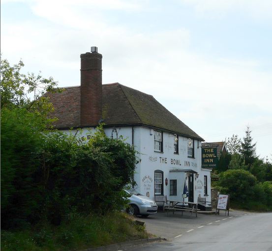
12.The Bowl Inn
[Grade 2 Listed building]
A Public House which is still in business. (Click for The Bowl Inn website)
The Bowl Inn barn
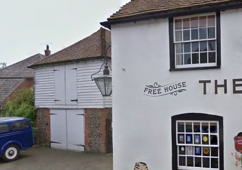
13.
[Grade 2 Listed building]
This is now the home of the Antiques buisiness run by the publican of the Bowl Inn.The building exterior resembles a barn, but with upper and lower floors internally and has had a number of commercial uses over the years.It isn't open every day, but worth a visit when it is open.
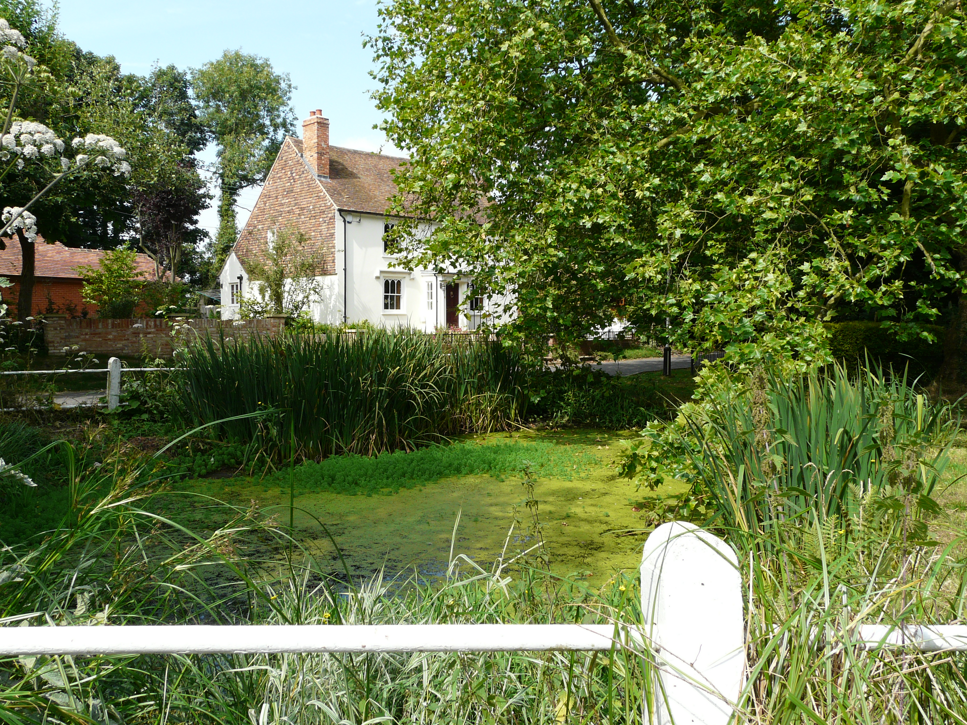
14. South View House
[Grade 2 Listed Building]
(private residence)
A Georgian Farm House, formerly by the name of Leese Farm, (in 1881 it was No.1 The Street, in 1891 it was called Cubison Villa after Cubison Stickles, the house dates from the late 18th century and overlooks the Village Pond.
Until recently it was the home of Gordon Lionel Davis the late sculptor & artist.(1926-4 Aug 2007)
15. Lyddendane Farm House
[Grade 2 listed building]
(private residence)
Current house was built in the mid 18th century by Thomas Pilcher (stone reads 1756), the farm estate had existed there for centuries, records date back to the late 13th century. This was one of the estates of the Pilcher family along with Coombe.
16. Hazel Tree Farm House
[Grade 2 Listed building]
(private residence)
It is located on Hassell Street, and dates to the 14th century, with later alterations.
17. The Woodmans [Arms]
[Grade 2 Listed building]
(private residence)
Hassell Street built 1698 formerly a public house called the Woodman's Arms-
at one time occupied by the actor Gerald Campion, best known for his role as 'Billy Bunter'. The house is now in private ownership.
18. Kingsmill Down Farm House
[Grade 2 Listed building]
(private residence)
predates 16th century. In 1973, a pit was uncovered during
ploughing which revealed pieces of Belgic and Romano-British Pottery. There is also the remains of a c.1700s donkey wheel..
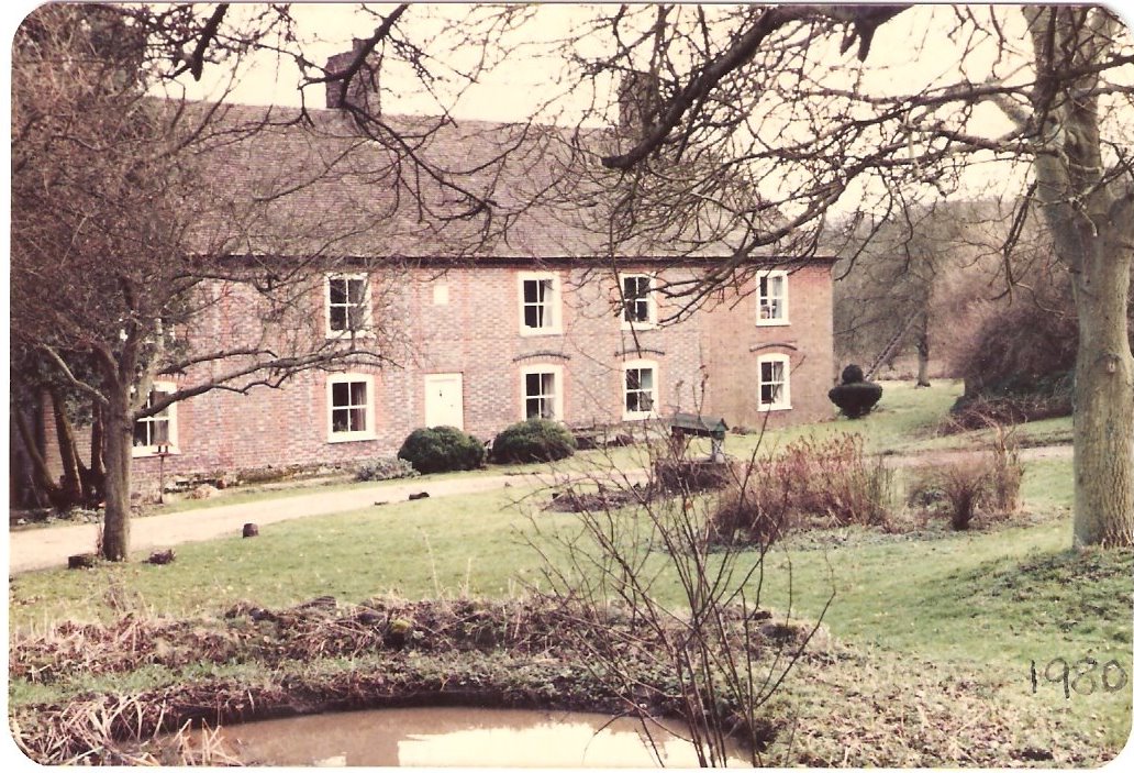
19., 20. & 21. Coombe Grove [Big Coombe] & two barns.
[Grade 2 Listed buildings]
(private residence.)
The main house contains elements which date to the early 1400's
Coombe Grove was the site of a WWII anti-aircraft gun placement for defence against flying bombs. It contained a 40mm gun manned by the 4th Light Anti-Aircraft Regiment of 27 Brigade. There was also a searchlight in place manned by the 502 Searchlight Battery of 79 Searchlight Regiment.
The two barns are dated from the 1500's and 1600's..
Protected Woodland:Moorlands Wood, which on an 1839 map was refered to as 'Planted Wood' for the left hand side and was a hop
garden to the right hand side. So the wood is not very old.

Sites of Historic Interest:1. Richard's Wood, long named as such and still retaining it's boundaries as shown in 19th century maps of the area.
2. Collyerhill Wood, formerly known as Cunning Knowt which was separated from Coombe Grove Farm
by Colvey Hill Field.
3. Land in the far west of the Parish (south of New Barn), currently not named on the maps, but in 1839 part of it was
called Hilly Field, partly in Downs Pasture and includes a chalk pit.
There are several shaws, and woods in the Parish which have existed for a very long time (centuries) without much if any
alteration to their boundaries. These ancient woodlands are not SSSI's but are protected as the whole parish falls within the
Kent Downs Area of Outstanding Natural Beauty.
1. Brabourne Downs: A large mound on the slopes of Brabourne Downs was ivestigated in 1971, to ascertain if it was made
as a result of ploughing or a deliberate construction. Investigations in 1975 uncovered iron age pottery and Romano-British
pottery as well as flints blades and scrapes.2. Barrows: A linear row of ringed barrows one 20 meters in diameter are on the top of Brabourne Downs, concentric is a ditch some
29 metres in diametre and 16 meters away is another.3. Smeed Farm: A broken neolithic axe head and several flint artifacts have been uncovered on land at Smeed Farm.