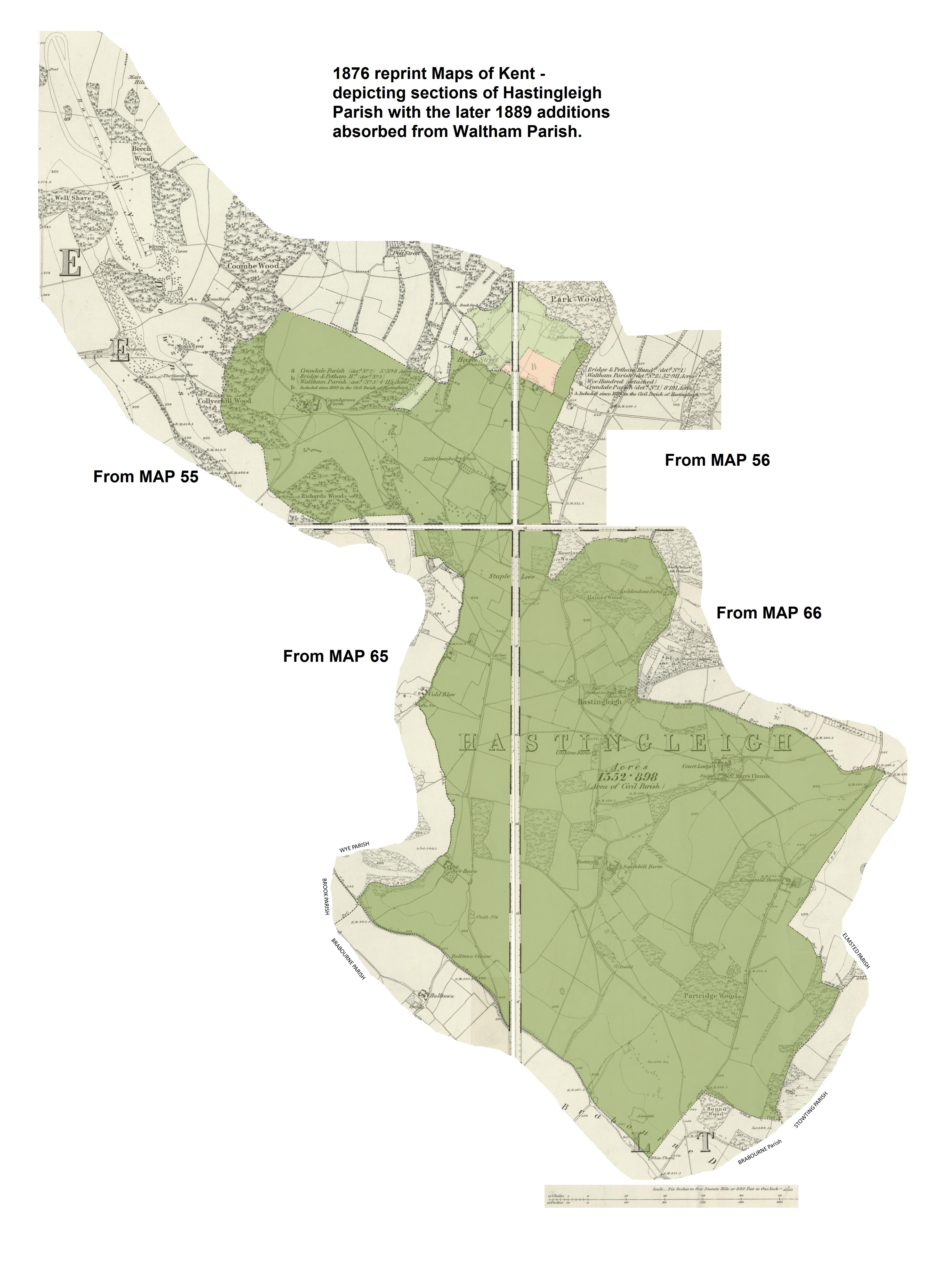
Note: I have included Wye Race Course in the top left corner of this map, to show how close it was to Hastingleigh.Hastingleigh.com A Genealogy Website /One Place Study Contact e-mail
Hastingleigh on Ordnance Survey Maps surveyed in 1876The following image is taken from 4 Sheets of Kent Maps.
Map Numbers 55, 56, 65 and 66. On the original 1876 map Hastingleigh extended over 152.889 Acres,
they were reprinted to reflect boundary changes which altered the Parish in size when 2 detached portions of Waltham
Parish were absorbed in to Hastingleigh in 1889. The one marked by lowed case letter "b" is just one field 4.115 acres,
and had previously been known in the census and else where as "Waltham Detached No.3."
The much larger "Waltham detached No.2" area, (marked by capital letter "A") brought almost 33 acres of new ground to within
the landscape of Hastingleigh, not including a trapped 8 acre site, (a field and a couple of cottage properties north of Hassell Street
formerly Hazel Street) which remained as "Crundale Detached No.1" and is marked by capital letter "B".
The original full maps can be viewed on an external website for the Library of Scotland.MAP 55 Click=North West, Coombegrove and Richards Wood, over to the Wye Crown.
MAP 56 Click=North East corner including previously "Waltham detached No.1"
MAP 65 Click=South West, Cold Blow, New Barn to Bull Town Corner
MAP 66 Click=for central Village, South Hill, Kingsmill Down and South East corner.

